
Follow us on twitter to get
the latest releases
|
|
Track Kit helps you to record, edit, keep and present your tracks. If you are looking for conveniet easy-to-use GPS tracker, Track Kit Pro is right for you.
Would you like to explore new places even before you start traveling? Do you want to share travel routes and pictures with your friends? You can easily do it with Track Kit app on your iPhone and iPad! The app is a great help in traveling, hiking, sightseeing, navigation, boating, hunting and finding your way around.
Track Kit – is not only multifunctional tracker but also a unique free web service for exploring and presenting your travel routes.
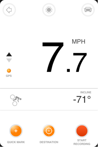
At First Glance
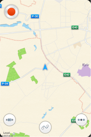
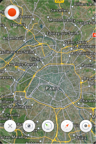
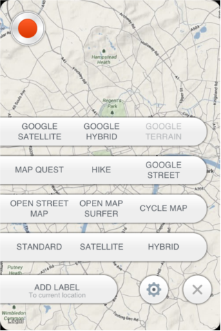
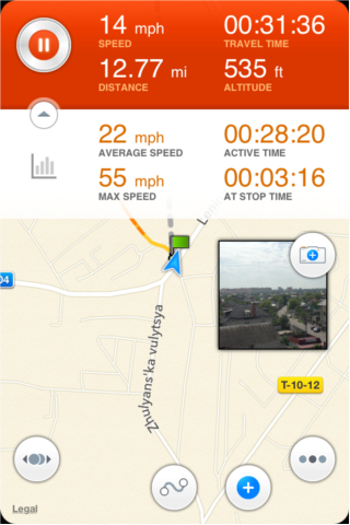
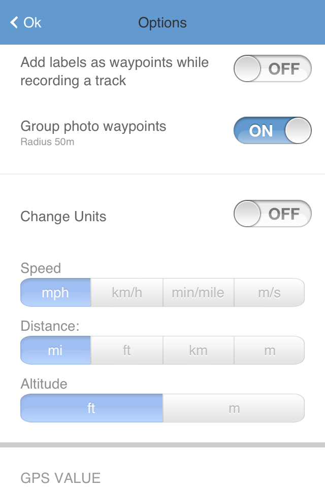
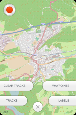
The main screen is focused on track recording. All the controls are located at the main screen. There are track recording button, "tools menu", " track menu" and "main menu" buttons located. Tools menu allows user to open rangefinder, compass, speedometer and map measurement tools. Track menu opens access to track, label and waypoint measurement. In the main menu you can change map format, add a labeel to the map and open options.
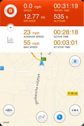
Recording a track
To record a trak simply press red "record" button.
While recording a track you can open/collapse additional statitics panel. A mini camera allowes to take a picture and create a waypoint on the go.
To add a waypoint press on a buton with blue circle at the bottom of the screen.
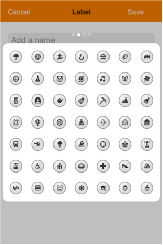
Labels and waypoints
Track Kit Pro allowes you to create labels and waypoints.
Labels are static marks while waypoints belong to a recorded track. Labels are NOT shared while you upload your trak to the server. Though labels can be tracked in camera screen.
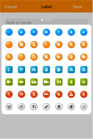
A label can be added by a standard long tap gesture. You can use main menu to add a label either.
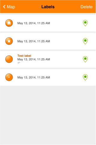
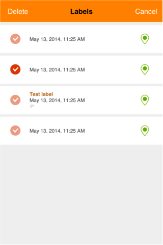
Managing labels and waypoints
Tap on the track menu button at the bottom of the main screen to open submenu with tracks, labels and waypoints.
You can edit or delete labels, change label icons, add description, images and audio notes.
You can choose between multiple icons. Just swipe left and right a list with icons.
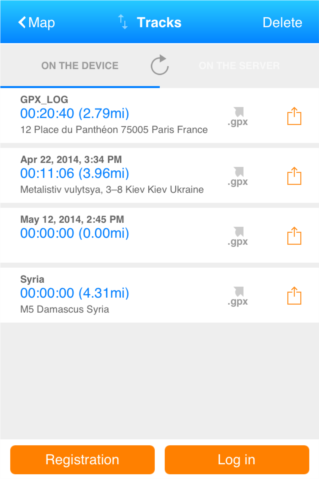
Tracks and paths
To open a track please tap on a track menu button at the bottom of the main screen. Select tracks. A track list shows tracks stored locally and on the server. To be able to store tracks on the server please register on the track-kit.net.
You can share your tracks without registration. All anonymous tracks will be removed from the server in 14 days.
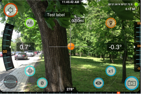
Augmented reality
Augmented reality is another cool feature of Track Kit app. You can measure distance to different objects,
BACK
Tap the "BACK" icon in the upper left corner of the camera screen to return to map mode.
A-B
“A-B” icon brings up distance/height calculator. You can measure distance or height of objects by selecting bottom “A” and top “B” points. This mode also shows angle difference.
CALIBRATE
Set your device to horizontal position and tap calibrate icon to adjust the sensors.
ZERO
Tapping this icon will TEMPORARY zero all angles at a given orientation of the device, thereby showing angles relative to that reference until you tap the icon again.
LENS
This icon toggles colored lens filters over the screen, which may be helpful to preserve night vision or improve usability in low light situations. The same button toggles the display back to normal.
ZOOM
This icon toggles the zoom level of Track Kit Pro's main display between 1X, 2X, and 4X.
CAMERA
This icon is used to take screenshots.
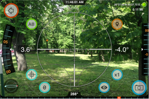
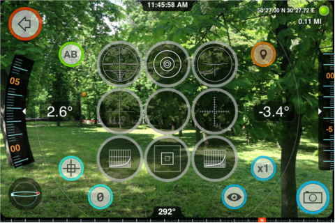
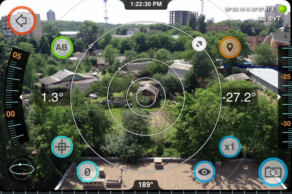
Sniper scope
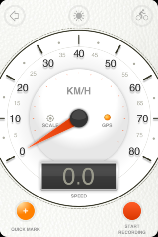
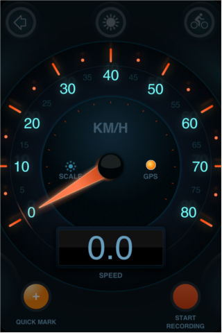
Speedometer
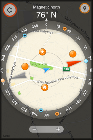
Compass
Measurements
Measuring distance and bearing to a label on the map.
Optical Rangefinders
Track Kit Pro's rangefinders allow you to quickly estimate distance to targets, objects, and landmarks, provided you know some dimension of the object in view.
To cycle through the various rangefinder reticles in Track Kit Pro, tap the center of the screen.
The first rangefinder is a distance/size multiplier-type rangefinder using rings. Default rings are 2x, 4x, 8x, and 16x, which indicate scale factors between distance to the object and the object size (ring diameter). Note that the scale factor of the rings will change with Track Kit Pro's zoom level.
As an example of usage, consider the storage shed shown in the screenshot clip below. The corner of the shed, known to be about 6 meters high, lines up with the "16" ring on the rangefinder. This indicates that the distance to the shed is approximately 16 times that height dimension; ie, 16 x 6 = 96 meters. The distance was later measured with a tape to be 102 meters, meaning Track Kit Pro's optical estimate was within 2% -- pretty good
NOTE.Rings an the other instruments must be calibrated first.
For best results, the object should be framed in a straight level view, but off-angle variations of up to 10-15 degrees won't affect accuracy too badly. Any dimension of the object can be aligned with the reticle rings, whether vertical, horizontal, or diagonal.
The rangefinder reticle rings have been setup to work on all current devices, taking into account the lens field of view and the screen resolution. However, the rangefinder can be calibrated -- both to accomodate future devices and to improve results when user-specific applications dictate a particular range of measurement. To calibrate, simply drag the "CAL" handle in a circular motion to "focus" the rings on a landmark with a known distance:dimension ratio matching one of the rings. You can double-tap the handle to reset the rings to the default calibration.
Next up is a standard mil-dot crosshair reticle. Dot spacings are 20 mils at 1X zoom, 10 mils at 2X zoom, and 5 mils at 4X zoom.
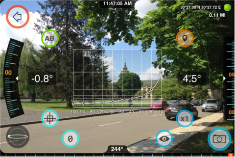
Next, Track Kit Pro includes two large format stadiametric rangefinders, similar to those used by snipers, hunters, and artillerymen. The first stadiametric option shows distance/height multipliers, and is usable with any reference target. By lining up the target with the curve scale, distance to the target can be estimated as a multiple of the target height. Note that the horizontal scale of the stadiametric curve is linear, such that graphical interpolation is possible.
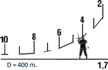
The second stadiametric rangefinder is unit-based, showing yards to a 5'7" stadia (when length units are set to ft) or meters to a 1.7m stadia (when length units are set to m). It also uses a linear horizontal scale to allow interpolation.
PSO-1 stadiametric rangefinder. The PSO-1 was at the time of its introduction around 1964 the most technically advanced telescopic sight ever designed for a mass-production designated marksman or sniper rifle.
Finally, Track Kit Pro introduced a variable 4X-24X rangefinder scope reticle. Drag the sizing handle to the right of the square reticle to fit the reticle to a vertical or horizontal dimension of the target. On the left, the scope displays the distance/size multiplier between distance to the target and the target size.
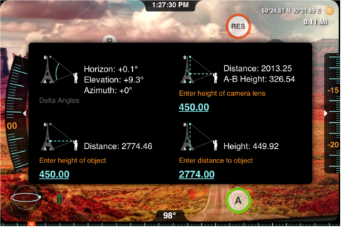
A-B Calculator
These functions calculate information from two observation readings, A and B. For long distance measurements, you can use the map.
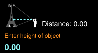
Height from A-B Elevation Angles
Aim at the bottom of the object to be measured and tap the A button, then aim at the top of the object and tap B. Tap (I) to open measurement screen.
To measure height input the horizontal distance to the object, then Track Kit Pro will calculate the object's approximate height based on the change in elevation angle between A and B. This is useful when you can easily make or estimate horizontal measurements but not vertical ones. You do not need to be on level ground for this measurement. Note that you do not need to specify units for this measurement -- the computed height will be in the same units as the input distance.
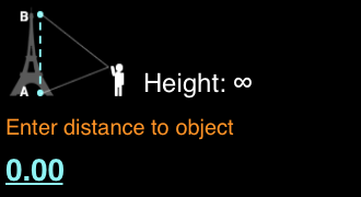
Distance from A-B Elevation Angles
Similar to above, but solves for horizontal distance assuming the object's height is known. Aim at the bottom of the object to be measured and tap the A button, then aim at the top of the object and tap B. Track Kit Pro will ask you to input the height of the object, then it will calculate the approximate distance to the object based on the change in elevation angle between A and B. This is useful to calculate range/distance to objects and landmarks with known height. You do not need to be on level ground for this measurement. Note that you do not need to specify units for this measurement -- the computed distance will be in the same units as the input height.
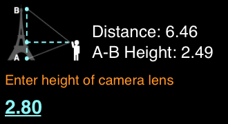
Distance and Height from A-B Elevation Angles
This method calculates distance and height simultaneously, though accuracy is reduced from the methods discussed above. In this case, the device height is used as the reference input along with the A and B elevation angles. This measurement requires that the user and object are on level ground. Note that you do not need to specify units for this measurement -- the computed distance and height will be in the same units as the input device height.
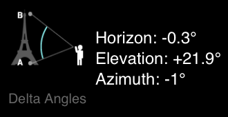
A-B Delta Angles
Track Kit Pro will calculate the difference in elevation, horizon, and azimuth (if available) angles between points A and B. Useful when you need to know the relative angles between two objects from a common position.
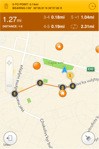
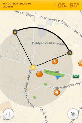
Measurements on the map
You can measure distance and radius usin the map.
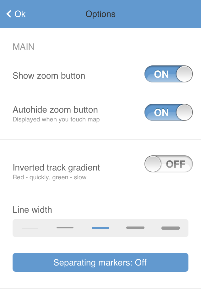
Under The Hood
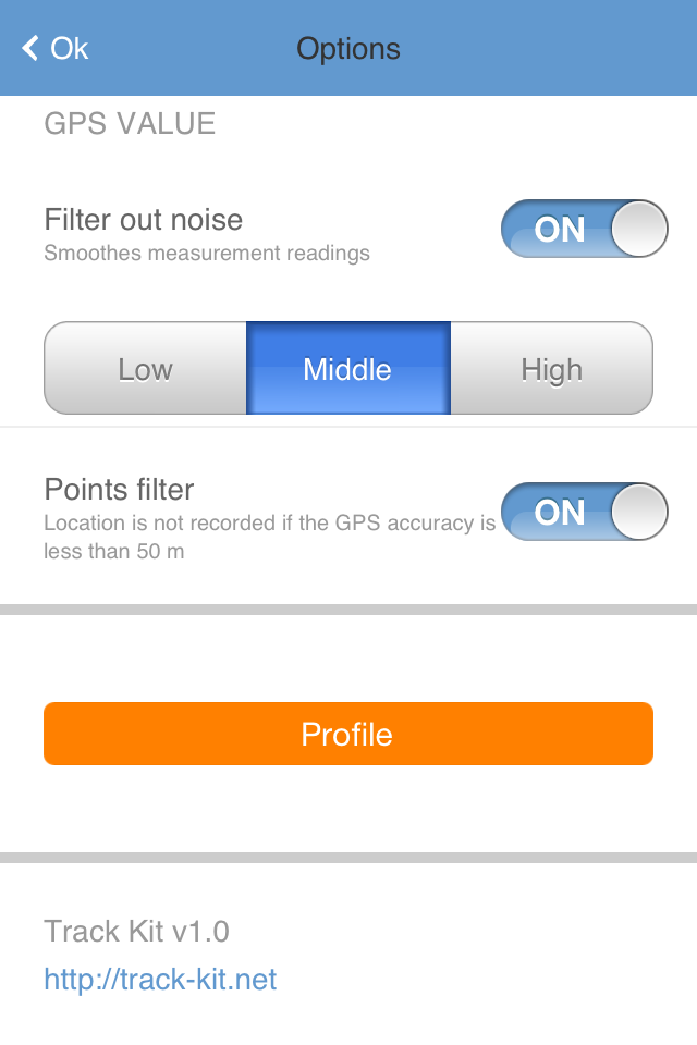
Track Kit Pro has options to control different aspects of the track apearence, user interface, GPS signal noise control, and other settings.
Track Kit Pro Video
|
|
| ‹ Back to Deluxe Moon page |
|
|